About RESTEC
Our Business
Sense your Earth
The Earth is beautiful and vibrant. However, in present times, the Earth faces environmental issues such as deforestation, global warming, and air pollution, and there are concerns for the impact that such problems may have on society and economy, in areas such as food safety, water resources, and climate change issues.
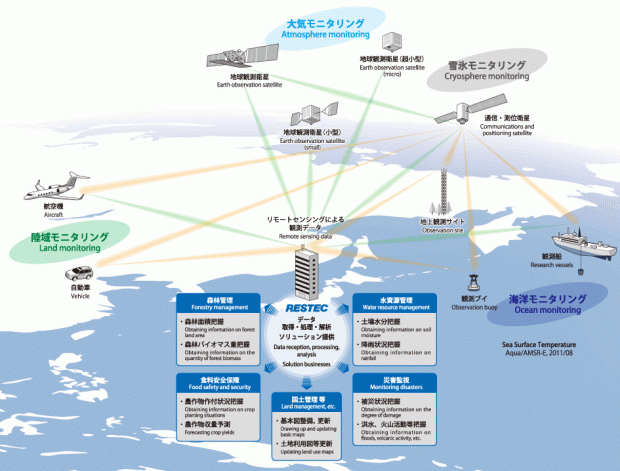
In order to get an extensive view of the entire Earth, it is necessary to make use of observation equipment (sensors) such as satellites, and apply remote sensing technologies to conduct observations of the Earth’s surfaces from a remote location.
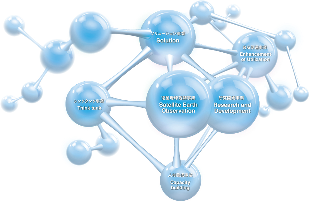
RESTEC aims to establish remote sensing technologies as a form of social infrastructure through comprehensive research and development, raising of awareness, and human resource development in the field of remote sensing, and by doing so, contribute to the development of social economy and improvement of the people’s lives. RESTEC uses this technology to obtain data and information from satellites, aircraft, automobiles, observation towers, ships, buoys, and other observation points.
By distributing the information obtained to users, RESTEC contributes to the resolution of issues such as environmental problems and climate change problems.
RESTEC communicates the Earth of the present times to you.
At the heart of the remote sensing industry
For the last 45 years since its foundation, RESTEC has been receiving and processing data acquired by both domestic and foreign earth-observation satellites and providing those
data to researchers and operational users under the contract with Japan Aerospace Exploration Agency (JAXA) and other related organizations. In parallel with those activities RESTEC has been conducting R&D of remote sensing technologies under the contract with pertinent agencies as well as independently and endeavoring to disseminate the achievement of those R&D.
RESTEC, as the core organization of satellite remote sensing in Japan, aspires to build remote sensing technologies as a social infrastructure, through providing policy makers, researchers and other satellite data users with remote sensing solutions by collecting, archiving, processing and analyzing remote sensing data required by the users.
Based on those experiences and proprietary knowledge it has acquired in the fields of satellite operations, analysis of remote sensing data, value added services and remote sensing trainings, RESTEC intends to expand its businesses in the new area such as providing remote sensing solutions not alone in domestic but international projects.
In addition, it implements basic and comprehensive R&D of remote sensing and provides both domestic and foreign personnel with training as well as promoting cooperation in many international projects from the viewpoint of public interest and welfare.


