AW3D® Japan High-definition 3D map
Digital 3D maps realistically simulate ground surfaces of all of Japan
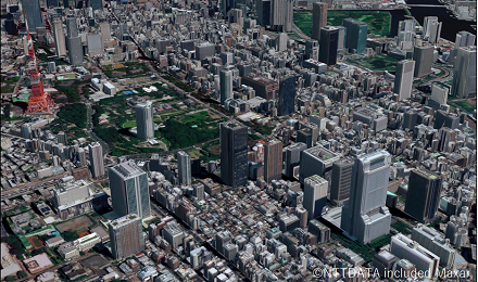
This service offers digital 3D maps with positional accuracy at a scale of 1:2,500 based on 50-cm-resolution 3D data. We offer ortho imagery, terrain data (DSM), and building 3D data for all of Japan, including remote islands. The latest data (to be updated once every two years) is always available. The maps can be used for a range of fields, including confirmation of the current situation, various analyses, and simulation applications.
-
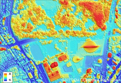
50cmResolution terrain data(High-definition DSM) -
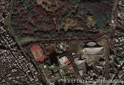
30cm~40cm resolution ortho imagery -
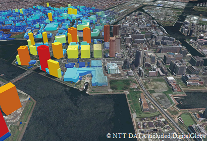
Building 3D data
Since the maps have horizontal and vertical positional accuracy at a scale of 1:2,500, maps can be overlapped without position misalignment between data and can serve as a base for map information. Terrain undulations are represented at 50 cm resolution, which is unprecedented for nationwide data. The maps can be used for high-precision coordinate and height measurements, quantity and gradient calculations (degree of incline), and simulation applications.
As the data is updated regularly, you can always find out the latest situation.
Using multiple satellites with excellent wide-area coverage, maps covering all of Japan including remote islands are created regularly. Compared to standard aerial survey data, higher frequency data can be obtained even for mountainous areas and remote islands.
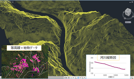
Since we have an in-house production line, we can provide maps tailored to customers’ uses, including contour and vertical cross-section maps and format conversions.
Use Case
-
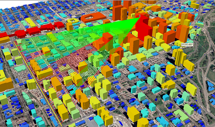
Civil engineering schematic design -
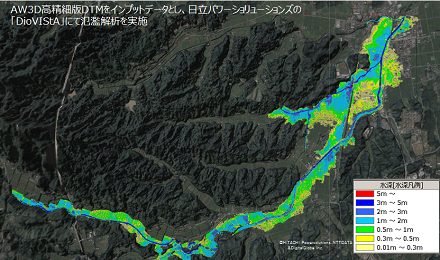
Flood analysis
-
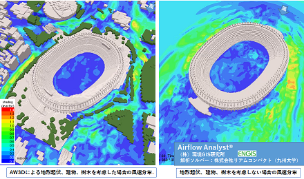
Urban air current analysis (wind flow simulation around the New National Stadium) -
Visualization
-
Forecast analysis and outlook simulation -
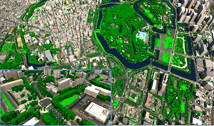
Green space management and greening planning
Details
| Product Type | DSM/DTM/Ortho Imagery/3D building |
|---|---|
| Resolution | 50cm~2m(Terrain data)、30~40cm(Ortho Imagery) |
| Satellite | Maxar(Old:DigitalGlobe)Satellites |
| Area | Japan |
| Horizontal Accuracy | 1.75m RMSE |
| Vertical Accuracy |
1m RMSE(Terrain data) 2m RMSE(3D building) |
| Minimum Order Size |
25mesh ※Area is purchased in units of 3D mesh as defined by the Geospatial Information Authority of Japan (1 mesh = approx. 1 square kilometer) |
| Delivery Formats |
GeoTIFF(Terrain data,Ortho Imagery) SHP(3D building) Collada(With texture 3D building) ※Please contact us for other formats |
| Delivery Method | FTP(on-line)、HDD、DVD ※Additional charges apply for delivery in HDD and DVD formats. |
| Optional Services | Optional services for a fee |
- Related Links